What to Know About Tropical Storm, Potential Hurricane Nate
Here's Everything You Need to Know About Tropical Storm Nate

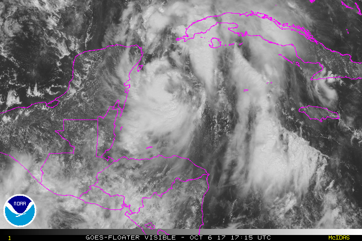
Tropical Storm Nate is expected to make landfall in the US as a hurricane this weekend, making it the third massive storm to hit the southeast in a period of just under six weeks. The storm has already resulted in the loss of 21 lives across Costa Rica, Nicaragua, and Honduras. Here's what else we know at this stage:
- Nate is currently driving sustained winds of 50 miles per hour and is moving north-northwest at 21 miles per hour. It's very likely that the storm will be upgraded to a Category 1 ahead of landfall in the Gulf Coast.
- The current forecast predicts that rainbands will arrive in the northern Gulf Coast states on Saturday, with landfall taking place sometime between Saturday night and Sunday morning. Nate will then move into the Tennessee Valley on Sunday evening and travel up through the Appalachians through midweek next week.
- A hurricane warning is in effect from Grand Isle Louisiana to the Alabama/Florida border. Hurricane watches are in effect for Metropolitan New Orleans, Lake Pontchartrain and Lake Maurepas, east of the Alabama/Florida border to the Okaloosa/Walton County line, and west of Grand Isle to Morgan City in Louisiana.
- Tropical storm warnings are in effect for Metropolitan New Orleans, Lake Pontchartrain and Lake Maurepas, and west of Grand Isle to Morgan City in Louisiana. Tropical storm watches are in effect for east of the Okaloosa/Walton County Line to Indian Pass, Florida, and west of Morgan City to Intracoastal City, Louisiana, as well as in Isle of Youth.
- Storm surge warnings are in place between Morgan City, Louisiana, and the Alabama/Florida border and on the northern and western shores of Lake Pontchartrain. A storm surge watch is in effect east of the Alabama/Florida border to Indian Pass, Florida.
- Louisiana as well as the city of New Orleans have declared States of Emergency.
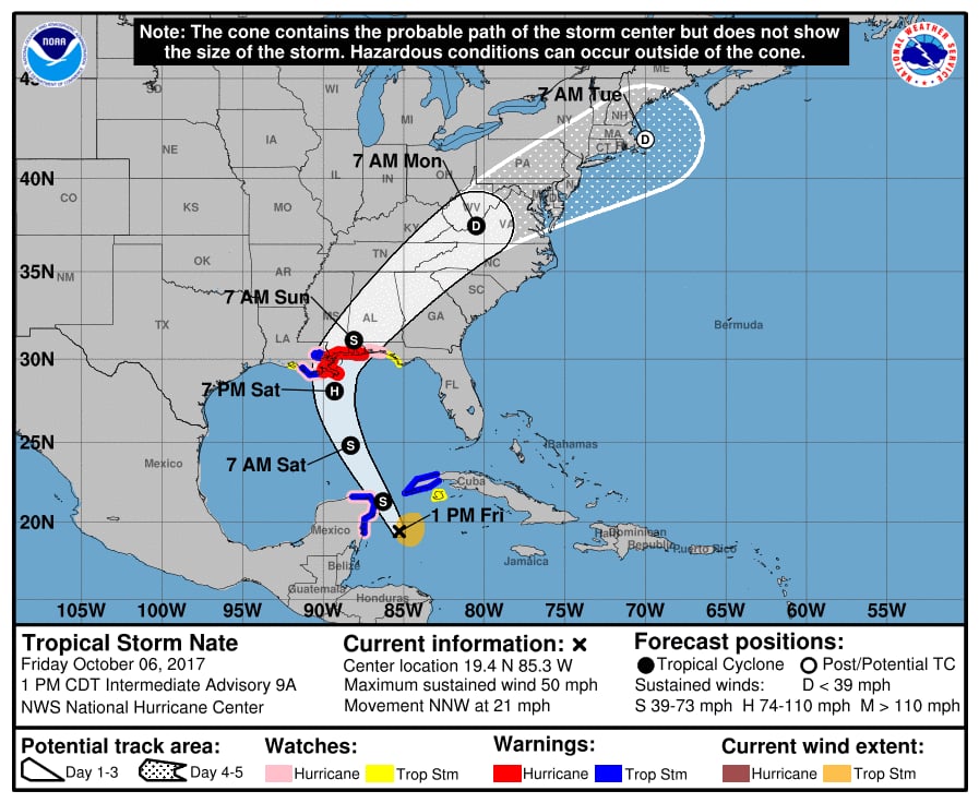
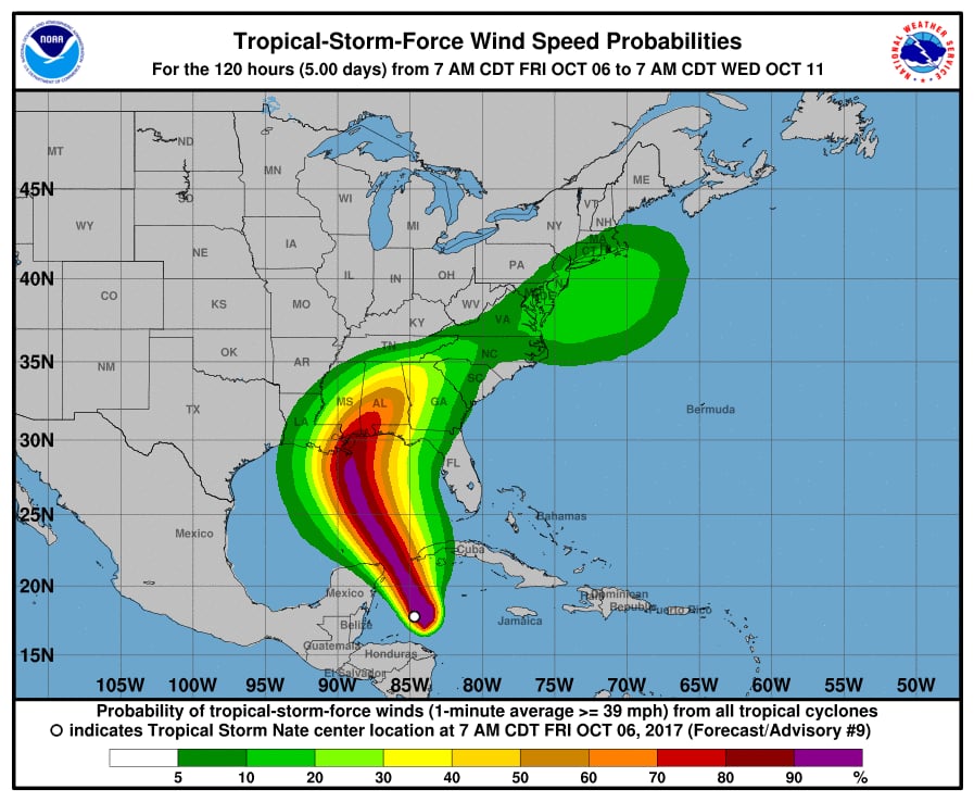


Image Source: NOAA